After Emperor Akbar awarded Raja Man Singh the Subehdari of Bengal, Bihar, and Orissa, Sarvesh war Singh, a commander under Man Singh of Amer, founded the kingdom of Jhargram in 1592 AD. Sarvesh war Singh was a Fatehpur Sikri-born Rajput Chauhan dynasty member. In honor of his triumph against the native Mal tribal rulers who ruled the region known as Jungle mahal, a statue of Mal Raja is still made and slaughtered on Vijayadashami day. As a gift, Raja Man Singh awarded Sarveshwar Singh Chauhan and his elder brother MansabDari of the whole Junglemahal region, placing it under their rule and subordination as a subordinate vassal state to Raja Man Singh.
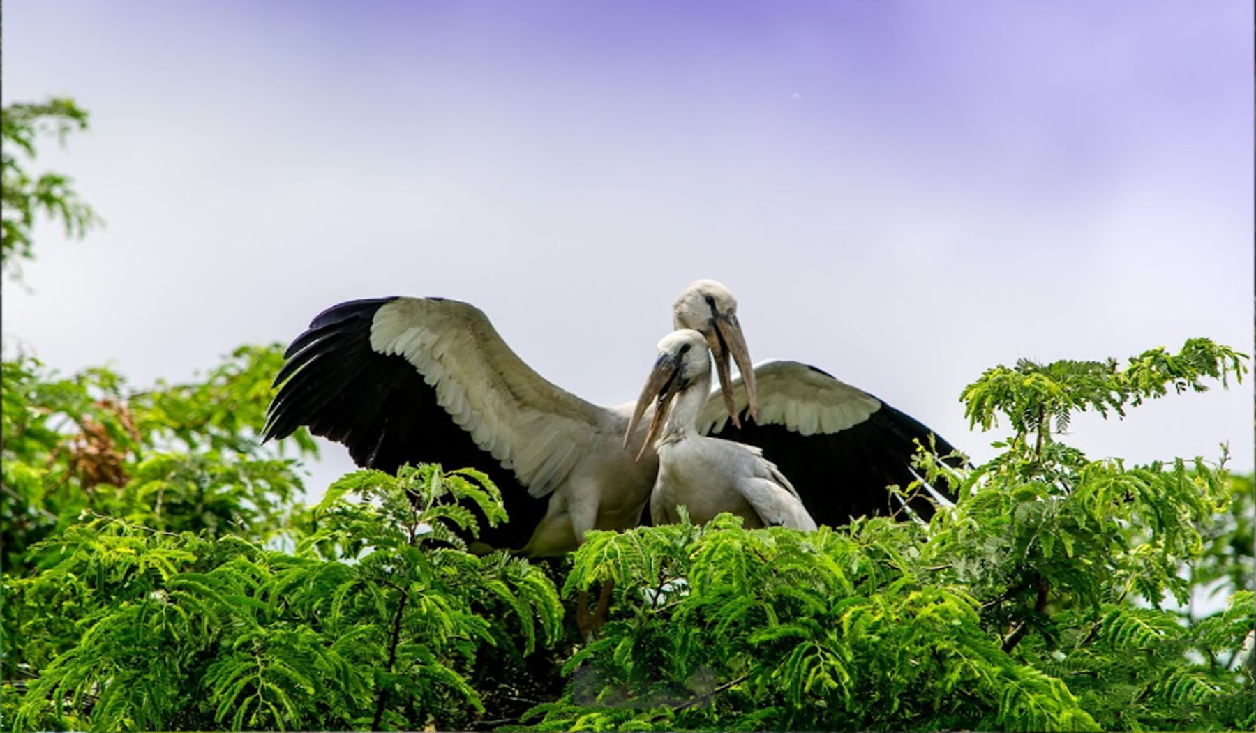
9 kilometers separate the town of Kendua from Jhargram, and Chilkigarh is the only route there. The little community of Kendua, which is located along the Jhargram-Chilkigarh route, is a favourite stop for birders. Migratory birds that mark the arrival of the monsoon season in Kendua do so around May. By November, they had flown away after hatching their eggs. The town of Kendua is more like wandering through a dense jungle. The many bird species and the sporadic changes in the environment are intriguing. Kendua village is a must-see location for individuals with a thirst for the natural world. Therefore, without further delay, take your friends, family, and loved ones on a tour of the wonderful town. There are many different kinds of birds.

In terms of biodiversity heritage sites, the holy grove at Chilkigarh is the third site in West Bengal and the twelfth site overall in India. The Jamboni forest, which has historically been protected for social and religious reasons, is located around 15 kilometers from Jhargram. Relict woods that are practically at the peak of their development make up the 60-acre-large grove east of the Dulung River. This highly regarded area is home to the Raj Palace of Chilkigarh and the historically significant temple dedicated to Kanak Durga, the founder of the Royal dynasty of Jamboni. The media weirdly underreports West Bengal's greatest holy grove, which is located in the Chilkigarh Kanak Durga temple complex.

The Kanak Durga Temple is 1.5 kilometers away and located on the other side of the Dulung River. With four wives—Rani Govindamani Devi, Rani Champani Devi, Rani Thakurmani Devi, and Rani Durgamani Devi—but only one child—Rani Subarnamani Devi—by Rani Champamani Devi, Raja Gopinath Singh Matagaj was the final ruler of Jamboni Zamindari. He reigned over a 110.63 km2 domain (married to Raja Jagannath Deo Dhabal Dev VII of Dhalbhum). He went away in 1765 AD without leaving a male heir, leaving behind Rani Champamoni Devi and Rani Thakurmoni Devi, both of whom participated in Sati with their husbands. His older dowager widow Rani Govindamani Devi inherited control of the estate after his death in 1818. 1822: Midnapore District Court.s
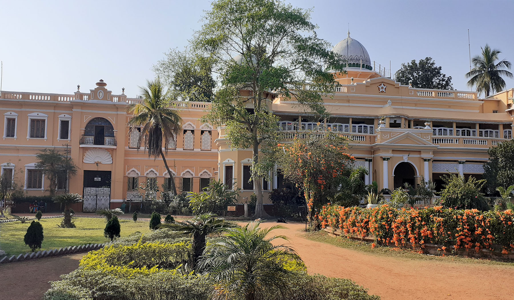
We took the village road to Jamboni and were ready for a peculiar adventure. The excellent location of Chilkigarh Palace has been a topic of discussion over the years. Early in the 13th century, Jagannath Dhabaldeb assaulted the Jungle Mahal. He gained the throne by rapidly and easily defeating the local ruler. As a result, Dhabaldeb chose Chilkigarh (Chilkigarh - Mysterious Jhargram) as his capital. After that, he rapidly constructed a regal home within the bush.
Chilki Garh is crossed by a slim branch of the Subarnarekha River known locally as Dulung. The so-called "Borgi" Maratha dacoits used to frequently assault this region of Bengal back then. Dhabaldeb built his castle on the other side of the Dulung River so that the water stream would shield his home from their attack.
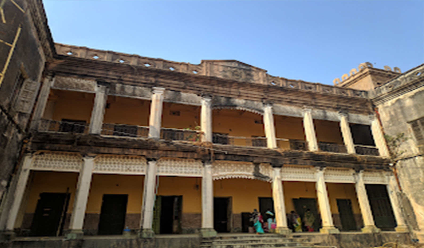
Recently, a shallow bridge was built. Yet, just one automobile may pass at a time even today. Once we had crossed the river, we came to an ancient archway. We came upon the Chilkigarh Rajbari while driving. Two stories made up the old palace. The building's colour was really strange. Dark grey with a finish of black stone! Sanyasi Raja, Aranyer Din Ratri, Durgesh Garher Guptadhan, and other well-known Bengali films were filmed at Chilki Garh and the area around it. After leaving our car in the front lot, we went for a stroll around the area. At one end of the campus, there stood a clock tower that appeared to have ceased keeping time a long time ago. The region seemed to have existed forever.
A tribal community called Belpahari is located 35 kilometers from Jhargram in West Bengal. From Jhargram to Belpahari, the pitch-black road is lined on either side by a dense canopy of tropical plants. Sal, Mahua, Piyal, Sonajhuri, and Eucalyptus trees line the area. This village's calm and quiet atmosphere is captivating. In Ghagra, a little distance from Belpahari, there is a lovely waterfall. The neighbouring Tarafeny Barrage is interesting to see.

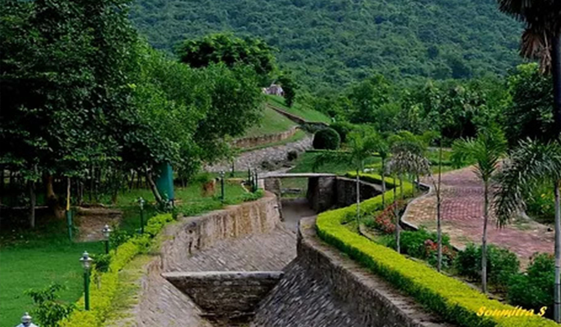
An irrigation dam called Khandarani Lake is bordered by enthralling trees and an endless range of mountains. Viewers are transfixed by the baffling wonders of nature as dazzling sunlight and whispering water currents make their way through the Dam channels and into huge tracts of agricultural land. Many bird species, including some migratory ones, swarm to Khandarani Dam throughout the winter months to spend the season carefree and fill the air with their unceasing flaps and flutters. You may either relax and take a leisurely stroll along the lake's edge or you can simply sit back and take it all in. Khandarani's abundant vegetation will astound you with its lush growth.
The Ghagra Waterfalls is an undiscovered tourist destination with rocks and stones scattered within deep vegetation. Visitors can marvel at the Ghagra's cascading streams as they tumble over the jagged rocks. Visitors are drawn to this magnificent waterfall by its eerie magnificence and majestic flow of unrestricted water currents. The area's rural surroundings, cryptic shrubs, and towering rocks give it an eerie feel. This is the location where the Bengali movie "Behula Lakhindar" was filmed. The monsoon season is the ideal time to witness the waterfalls' magnificence.
Gadrasini Hill is 8 kilometers away from Belpahari. The stillness here will make you feel at peace and serene. The Gadrasini Ashram is located at the foot of Gadrasini Hill. People from many walks of life come to the Ashram to meditate in tranquility since it is a center for spiritual practices and beliefs. The institution, which was established on the principles of Lahiri Maharaj and Swami Yogananda, offers guests a unique opportunity to encounter spiritual enlightenment. There are two temples in addition to the ashram, one of which is dedicated to Lord Shiva and the other to Lord Vishnu. If you're up for it, you may also check out Jagadananda and Debi Ma Guha.
Tarafeni and Belpahari are separated by seven kilometers. Another attractive place is where tourists are mesmerized by the quick swing of river currents against the rocky rocks, especially during the rainy season. The zigzag channels there are where the meandering river currents may be seen. This barrage represents a vital source of drinking water for thousands of locals. Tarafeni River receives the majority of its water from Mukutmanipur Dam. The Barrage's splendor shines even more when more water is released from the canals, and the whirling, leaping currents of water leave one in awe of nature's wonders.
Laljal Cave is 19 kilometers away from Belpahari. Laljal is a charming alpine village. There are artifacts and primitive cavemen from Belpahari in the village. This region's spring water has a little scarlet tint. When water, copper, and iron are united, the flavors are pleasant. Locals claim that the settlement's name, lalajala, derives from the river's red color. West of the town is a primitive caveman named Deopahar. Sinlahara is located in the mountain range's southernmost section. The community is located in Ranipahara's north. In the past, Abahelitai experienced a flourishing civilization. This region is home to some of the best natural wonders and tourist attractions.
Dhangikusum is situated at a distance of 13 km from Belpahari on the way to Kankrajhor, just turn left from Chirakuti and reach Dhangikusum View Point. Mazy paths, ups and downs, crisscrossing roads, and wild greenery with Sal, Pial, Kendu, Simul, etc. which is something memorable. Dhangikusum (locally known as Dungri) Falls is just 1km from the viewpoint. Dhangikusum Village is popular for its stone craft and you can purchase handicraft products.
Sometimes in life, the biggest surprises come in little packages. The tiny town of Baghmundi may initially seem like a typical village, but once you visit, your perspective is certain to change. The village's location at the foot of the Ayodhya Hills provides visitors with a pleasant escape from the stress and tension of contemporary life. When you see the area's quiet, uneven scenery, gushing waterfalls, trickling rivers, and diverse flora and fauna, you'll be in awe. Bamni Waterfall is one of the region's primary attractions. This waterfall never stops and is encircled by stunning landscapes and lush greenery. Another popular tourist attraction is Khairabera, a picturesque lake surrounded by gradual hills and thick forests.

Life's best shocks occasionally come in modest packages. One of the area's main draws is the little village of Bamni Falls. A lovely setting and vibrant vegetation surround this permanent waterfall. Many visitors come here from Baghmundi, Ajodhya Hills, and Murguma each year. You may reach the front of the stunning Bamni Falls after a 20-minute descent down a steep and sparsely vegetated track from the main road. The falling waterfalls create a little lake below by pouring over the rocks. Although there are several vendors next to the road offering a range of handcraft products and other goods, you may also engage in some shopping.
Visitors love to visit this waterfall, which is close to Bamni Falls. You can see the cascading white streams from the main road through chinks in the forest canopy. The soothing sounds of various colored birds and chattering squirrels give a tranquil environment away from the noise and bustle of the metropolis.
Another tourist spot close to Baghmundi is Khairabera, a lovely lake encircled by gentle slopes and a thick forest. The area's tranquility, diverse topography, falls, streams and thick vegetation are all attractive features. The Palash trees' orange-red springtime blooms contribute to the area's natural splendor. Because of the region's abundance of natural scenic beauty, Khairabera is a well-liked tourist attraction.
This 800-foot-tall hill, known as Pakhi Pahar, served as the canvas for the carving of 65 bird sculptures by the artist Chitta Dey and his associates. The hill is now a well-liked tourist attraction, and the seasoned artist's unshakable dedication and excitement sometimes bring people to tears. An excellent place to see birds is Pakhi Pahar, which is encircled by a thick forest.
The Purulia Pumped Storage Project includes both the upper and lower dams (PPSP). Engineering wonders, these enormous reservoirs. Hydroelectric power is produced using the water from these reservoirs. The roadside overlook located between the Upper Dam and Lower Dam is particularly magnificent while looking towards the Lower Dam.
In addition, Marble Lake, which is adjacent to Ajodhya Hill Top, is accessible. Those who want to feel tranquility and isolation must visit this turquoise lake situated in a desolate landscape. As you arrive, the enchanting splendor of the location will mesmerize you. As the local rocks were mined for stone to build irrigation dams, this man-made lake was created. The Marble Lake is surrounded by tall, craggy cliffs that hang above the azure waters. Two contrasting perspectives—from the top and the side—allow you to take in the beauty of the lake.